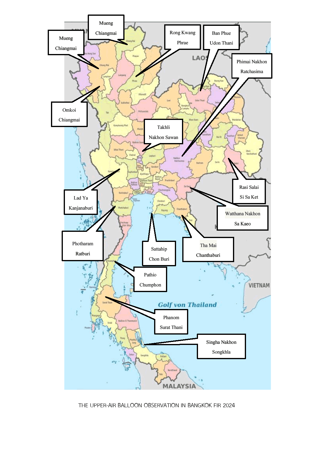
| 1. Omkoi Royal Rainmaking Radar Station | 17° 47' 54.17" N | 098° 25' 57.02" E | TIME OF OBSERVATION
0000 – 0200 UTC and
0600 – 0800 UTC AVERAGE HEIGHT
52,000 FT RADIUS
32 NM (60 KM)
from the coordinate of location |
| 2. Phrae Provincial Land Development Station | 18° 19' 21.61" N | 100° 18' 06.98" E |
| 3. Takhli Royal Rainmaking Radar Station | 15° 14' 48.84" N | 100° 20' 11.63" E |
| 4. Ban Phue Sub District Administration Phimai Royal Rainmaking Radar Station | 17° 33' 51.88" N | 102° 41' 04.32" E |
| 5. Phimai Royal Rainmaking Radar Station | 15° 10' 54.59" N | 102° 33' 50.92" E |
|
6. Rasi Salai Sub District Administration
Phimai Royal Rainmaking Radar Station
| 15° 18' 48.00" N | 104° 06' 38.00" E |
| 7. Sattahip Royal Rainmaking Radar Station | 12° 38' 56.75" N | 100° 57' 45.64" E |
|
8. King Mongkut’s Institute of Technology Ladkrabang
Prince of Chumphon Campus, Chumphom Province
Sub District Administration
Phanom Royal Rainmaking Radar Station
| 10° 43' 55.47" N | 099° 21' 54.24" E |
| 9. Phanom Royal Rainmaking Radar Station | 08° 50' 53.53" N | 098° 48' 34.22" E |
|
10. Singha Nakhon Sub District Administration
Phanom Royal Rainmaking Radar Station
| 07° 19' 54.72" N | 100° 25' 35.32" E |
|
11. Kanchanaburi Airport Sub District Administration
Takhli Royal Rainmaking Radar Station
| 14° 07' 37.00" N | 099° 26' 44.00" E |
|
12. Chanthaburi Airport Sub District Administration
Sattahip Royal Rainmaking Radar Station
| 12° 37' 45.70" N | 102° 01' 44.00" E |
| 13. Chiang Rai Meteorological Station | 19° 57’ 41.04" N | 99° 52’ 53.4" E |
| 14. Chiang Mai Meteorological Station | 18° 46' 17.0" N | 98° 58' 09.1" E |
| 15. Photharam Airport | 13° 40’ 11.28" N | 99° 44’ 3.12"E |
| 16. Wing 3 Sa Kaeo | 13° 45' 22.9" N | 102° 18' 32.6" E |

