1 INTRODUCTION
This section supplements the following portion(s) of the AIP: AD
1 With effect from 1 April 2022 at 0100 UTC to 30 June 2023 at 1000 UTC, the purpose of this AIP Supplement is to inform all concerned regarding the temporary installation of Ground-Based Augmentation System (GBAS) proof of concept equipment. This project is a part of a join technical collaboration between Japan (by the Ministry of Internal Affairs and Communications and the Ministry of Land, Infrastructure, Transport and Tourism) and Thailand (by the Civil Aviation Authority of Thailand). The main objective of this collaboration project is to install a GBAS equipment at Suvarnabhumi International Airport and conduct an experiment for the deployment of GBAS at low geomagnetic latitude area, of which the performance of GBAS is affected by the ionospheric irregularities (e.g. equatorial plasma bubble (EPB) and equatorial ionization anomaly (EIA)).
2 DETAILS OF EQUIPMENT
2.1 GBAS system consists of VHF Data Broadcast Transmitter (VDB) 1 unit, Data Processing Shelter 1 unit and Reference Receiver (RR) 3 units.
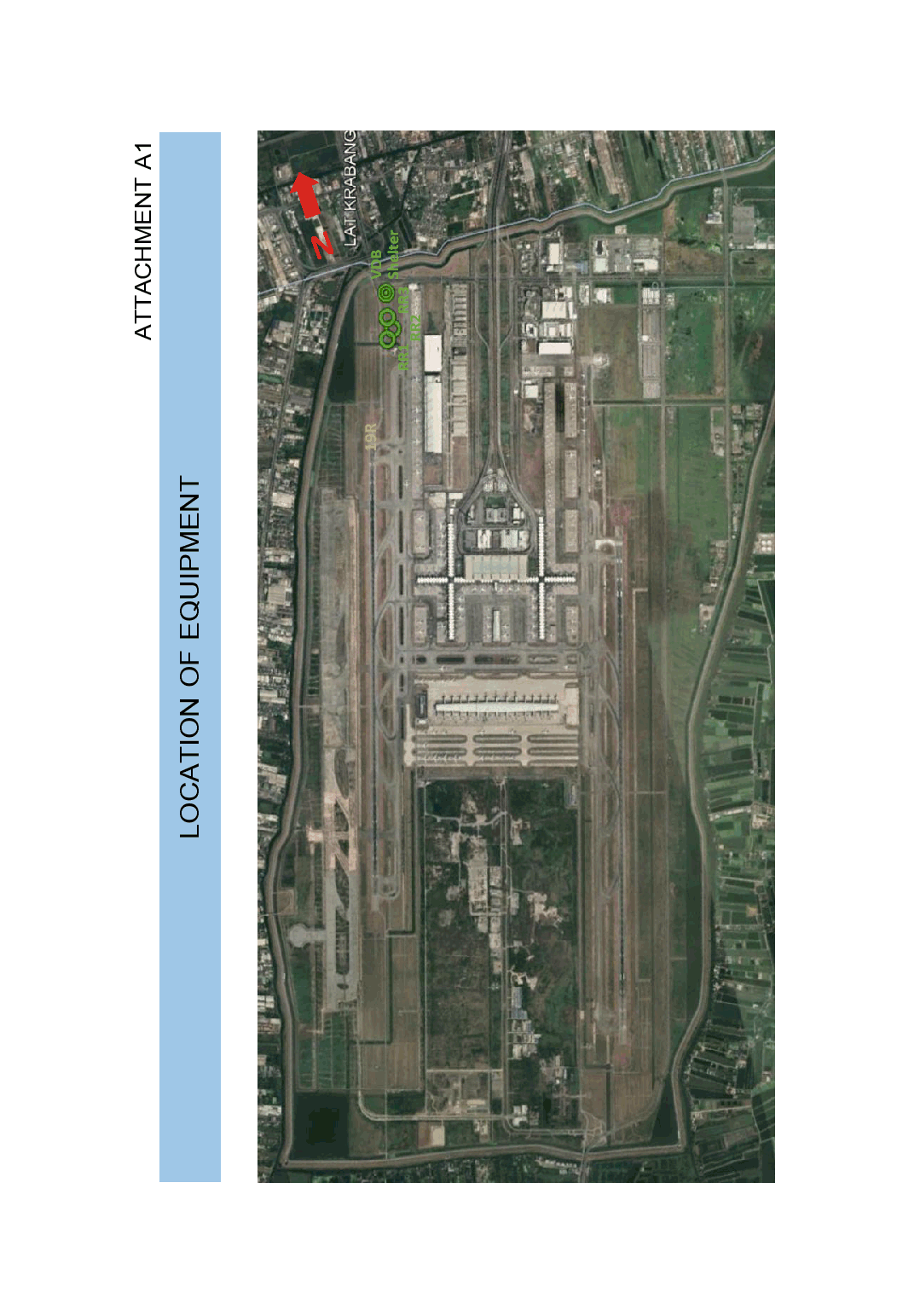
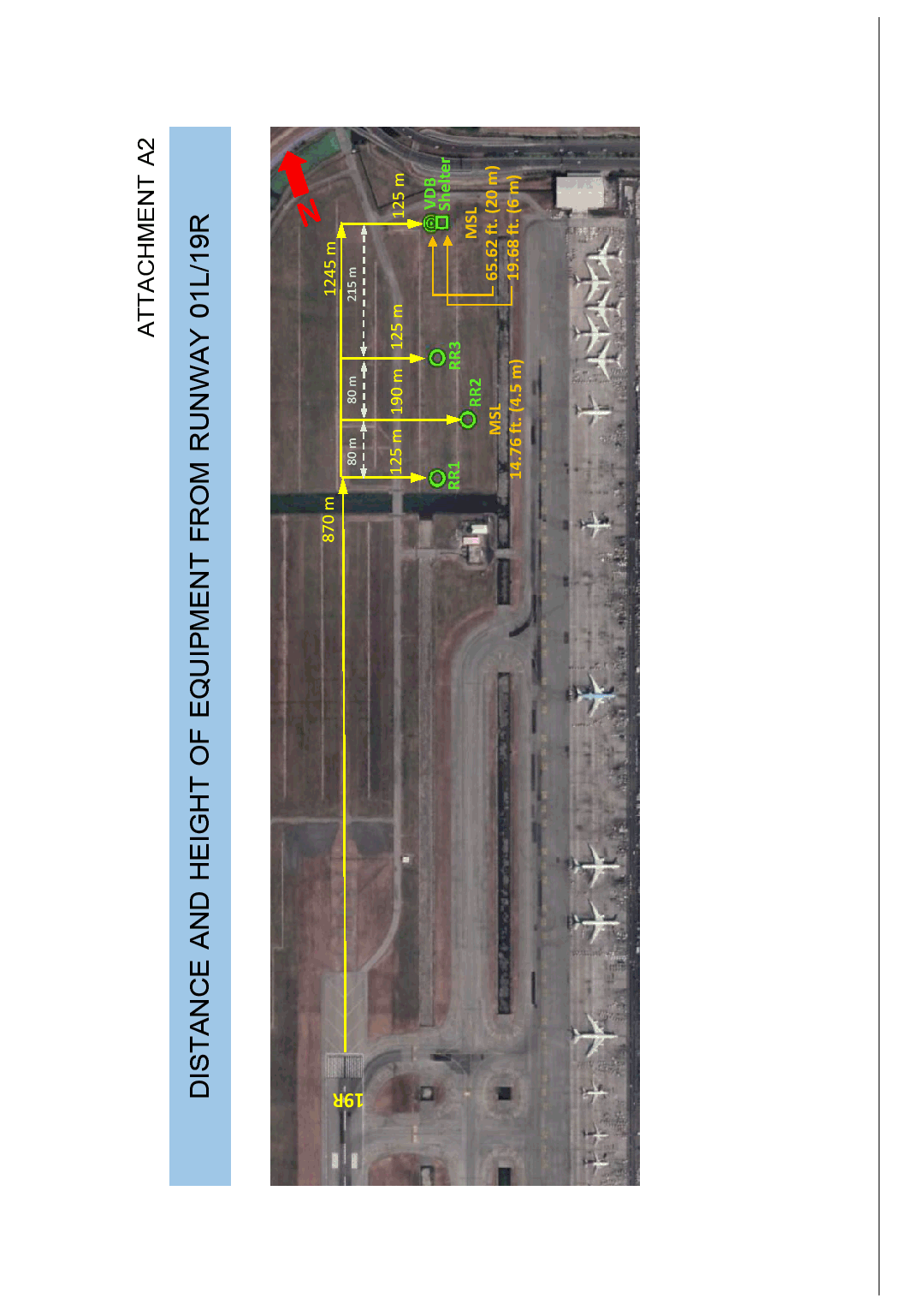
2.2 The distance of installed equipment is 870 - 1245 metres north of runway threshold 19R and 125 - 190 metres east of runway centre line 19R.
2.3 The maximum height of equipment is 62.34 feet (19 metres) above ground level (AGL) or 65.62 feet (20 metres) above mean sea level (AMSL), the details are shown in the table below.
|
No.
|
Equipment
|
Coordinates
(WGS-84)
|
Height
(AGL)
|
Altitude
(AMSL)
|
|---|
|
1
|
VDB pole
|
134251.31N 1004450.24E
|
62.34 FT
(19 M)
|
65.62 FT
(20 M)
|
|
2
|
Data Processing Shelter
|
134251.31N 1004450.24E
|
16.4 FT
(5 M)
|
19.68 FT
(6 M)
|
|
3
|
RR antenna - 1
|
134239.19N 1004447.37E
|
11.5 FT
(3.5 M)
|
14.76 FT
(4.5 M)
|
|
4
|
RR antenna - 2
|
134241.57N 1004449.66E
|
11.5 FT
(3.5 M)
|
14.76 FT
(4.5 M)
|
|
5
|
RR antenna - 3
|
134244.88N 1004448.87E
|
11.5 FT
(3.5 M)
|
14.76 FT
(4.5 M)
|
2.4 The area lay-out is shown in attachment A1 - A3.
4 CONTACT
4 For further information contact via the following:
4.1 Unit: Air Navigation Services Standards Department of the Civil Aviation Authority of Thailand
Tel: +662 568 8825
Mobile: +666 3205 8825
E-mail: [email protected]
4.2 Unit: Aeronautical Information Service Sub-Division of Suvarnabhumi International Airport
Tel: +662 132 6931-4
Mobile: +666 2598 0608
E-mail: [email protected]


